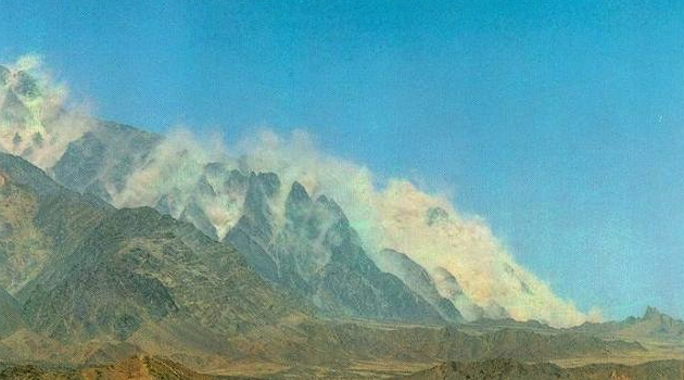
Half a day south of the N40 highway in Pakistan, the main road heading west to Iran through the Baluchistan desert, lies the Ras Koh mountain range. Steep, rugged mountains with little or no forest cover cut by deeply incised “nallas” or dry stream beds which you don’t want to be stuck in when it rains. Not that it rains very often. I was there in 1997 prospecting for porphyry copper systems, hot on the heels of BHP’s massive Reko Diq discovery in the Chagai Hills.
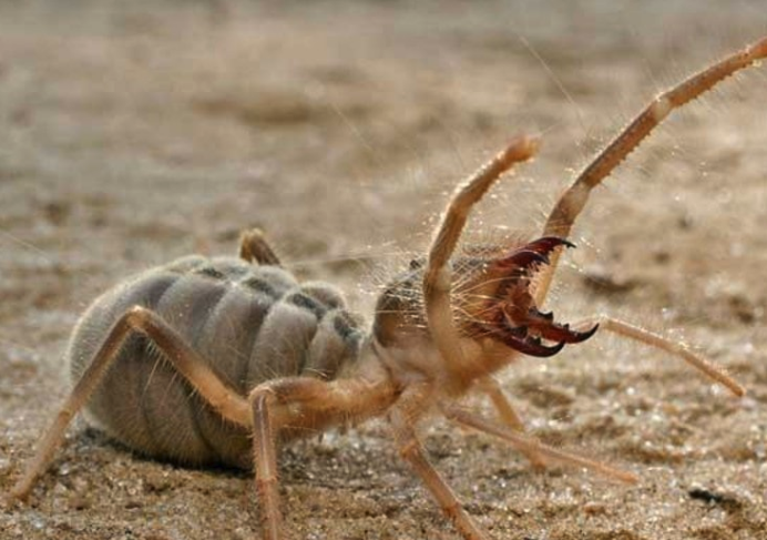
Getting there was a 2 day drive from Quetta along the N40 dodging Iranian and Pakistani trucks. The driving was some of the worst I’ve ever experienced; if you ask me it’s a bloody miracle any trade ever makes it across the Iran-Pakistan border in one piece. Once you left the road to head south, you might come across convoys of armed pick up trucks smuggling opiates to the Makran coast. And then there were the delightfully named Camel Spiders; hairy orange buggers with huge jaws that may or may not eat camels.
With only a very basic map and a GPS, accompanied by a dignified elderly Pakistani geologist, Naseem (who spoke Baluchi) and 2 government soldiers, I was trying to find a way in to the centre of the Ras Koh range. Detailed satellite image processing in head office had flagged a large area that looked like it might be a porphyry system and which had to be checked. But after 2 days hiking we gave up. There was simply no easy way in that didn’t involve some pretty extreme camping and we weren’t equipped for it. So, Naseem recommended visiting the local governor to find out if there were any tracks or roads that we hadn’t tried and off we went to find him in Dalbandin.
Dalbandin is a particularly unpleasant little truck service town. Dirty and hot, with –back then- only the cockroach-infested government hostel to stay in. What followed was a typical Middle Eastern tea-and-cake session with the Gov’ to honour the foreigner (me). Any excuse for a nice slice of jam sponge. After a couple of hours reminiscing about the glorious legacy of the British Empire (I kid you not) he looked at our map and drew a large triangle around the area we’d been trying get into and said in perfect English “Stay out of here” with no explanations given. On the way out, Naseem told me we should forget about that particular target and move on.
We headed west to Fort Saindak to chase different targets out on the westernmost point of Pakistan where the Iranian, Afghan and Pakistani borders meet.
Six months later the Pakistanis detonated 5 atomic bombs at their top secret test facility in the middle of the Ras Koh range. Our satellite photos had picked out the spoil heaps from the underground tunnel excavations. I’d been trying to hike into a nuclear test facility: a westerner with a digital camera and a GPS. Hello… Is that the Darwin Awards?