
A Walk Along The Edge Of The Roman Empire
Two thousand years before Donald Trump’s underfunded (and, as yet, fruitless) efforts at walling in the US, the Romans were busy building walls on the outlying borders of their vast empire. In Scotland, they built the Antonine wall in AD142. It was a 63km long earth bank cutting east to west across the country at its narrowest point. And in today’s modern Germany, you can still see remnants of the Limes Germanicus, a partly-fortified frontier that used a combination of natural obstacles and wooden palisade to guard the northern border of the Empire from the dastardly unconquered Germanic tribes.
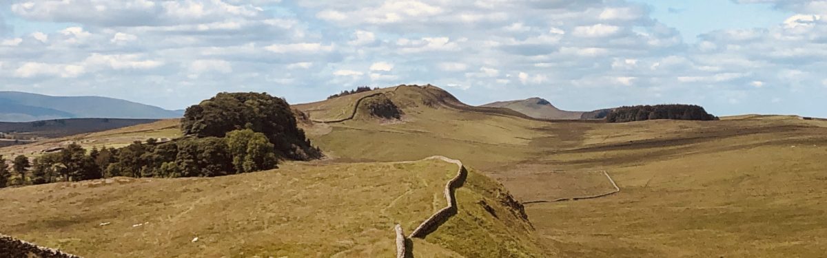
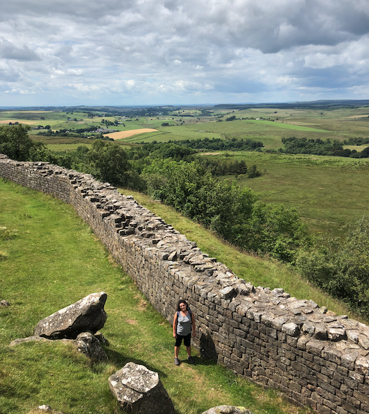
But Hadrian’s wall in northern England is probably the best known. It stretches for over 70 miles across hill and valley from the east coast of England, at Wallsend in the outskirts of modern day Newcastle, to Bowness on Solway on the west coast. Bowness is an isolated but attractive little village that’s periodically cut off from the rest of the country by high tides on the Solway Firth.
Fatter, Yes. Lazy, No.
In July, my wife and I spent a week walking along the known path of Hadrian’s wall. We strolled, ambled or hiked about 175km over 7 days, taking in some of the best scenery Britain has to offer, trying in vain to cope with a high calorie diet of full-English breakfasts and hearty evening pub meals. Even walking 25km a day, we both gained weight.
We did the walk the easy way. All the B&Bs were booked for us by a wonderful travel company in northern England who also arranged for our bags to be moved between guest houses each day (by a company called Hadrian’s Haul!) So we walked carrying only small day packs while White Van Man did the heavy lifting for us. For taking all of the hassle out of a trip, I can’t recommend it highly enough.
Back to the wall.
I Know. Let’s Build A Wall. A Big One.
Like any peacetime army, the legions of Roman troops stationed on the border needed something to do. Many of the soldiers had a trade -leather workers, masons, blacksmiths- but first and foremost they were soldiers, albeit troops who were bored for months at a time when there were no kilted Scottish devils to kill. To smooth out the long periods of tedium, their commanders gave them a make-work scheme; building a bloody huge, 117km long stone wall.
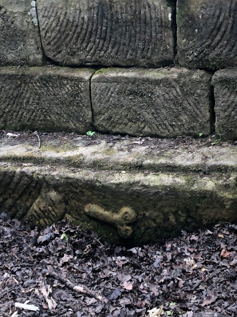
We’ve all seen movies about the Romans with their armies of slaves, dying in their thousands as they’re worked to death. But here that imagery couldn’t be more wrong. The wall was built by the soldiers, and they took a fierce competitive pride in the speed and quality of their workmanship. There are numerous examples of stone plaques and graffiti proudly announcing which Legion had built some particular section of it.
The chosen route was divided into lengths of about 8 kilometres (5 miles) and each Legion -roughly 5,000 men- stationed along the route was given one or more sections to build. Hundreds of soldiers would excavate the foundations and build the mile castles and turrets, and a separate group would follow along building the actual wall. It is believed that about 15,000 soldiers were involved in construction of the wall.
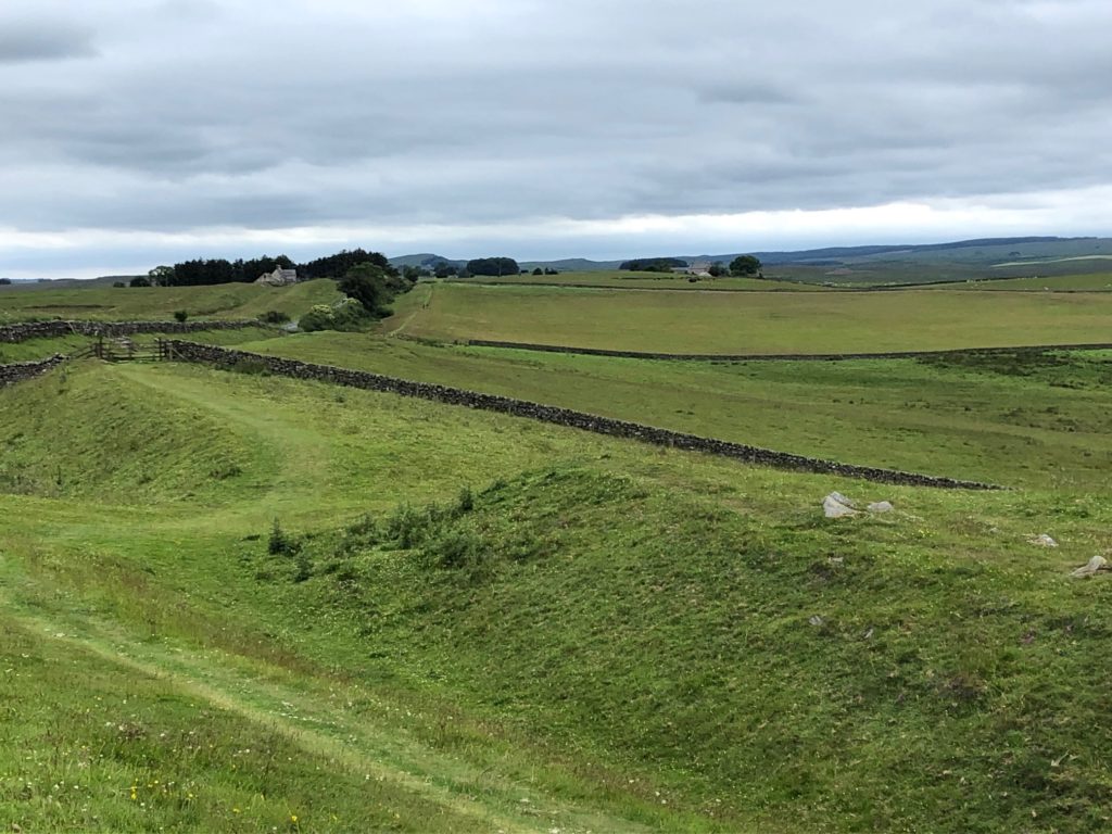
It took them about 14 years to build the 117 km long wall, at a pace of roughly 8.5km a year. That’s an incredible 700m a month, or nearly 25m a day for a 5m high, 3m wide stone wall. I can’t imagine doing that with modern construction equipment let alone with picks and shovels. Modern road crews with 5 supervisors and 2 workers wouldn’t finish 10m of it in 14 years. But build it they did, with a massive parallel defensive ditch (the Vallum) and turrets every mile or so, plus 16 large forts dotted along the route.
What Was It For?
The wall had a number of purposes, serving as a defensive frontier, but also controlling trade through the regularly spaced gates where passage north or south could be carefully controlled. No doubt it also functioned as a statement to the British tribes, along the lines of “We’re the bloody Romans. We can build big things. Don’t fuck with us.”
Where Has It Gone?
Be warned; for much of the route, the wall has been completely destroyed. You can walk for miles along lovely leafy foot paths, in and out of fields, politely sign posted “Hadrian’s Wall Path”, but the only walls you’ll see are recent dry stone walls around farmers’ fields. At other spots, all that’s left to see is the hand-dug Vallum ditch that ran parallel to it along its length.
Where did it go, I hear you ask? Good question.
In the 1700s, the English decided to build a military road from the east coast to Carlisle to aid in the defence against the shifty Jacobite forces –supporters of the erstwhile monarch Charles Stuart- lurking in Scotland. The road, as conceived, would allow rapid movement of troops across the north of England if Charles’ forces decided to move south. The task of constructing the road was handed to General George Wade.
History hasn’t been kind to General Wade. He’s now seen as the perpetrator of one of the greatest acts of cultural/archeological vandalism in British history.
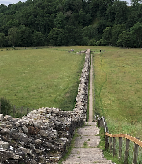
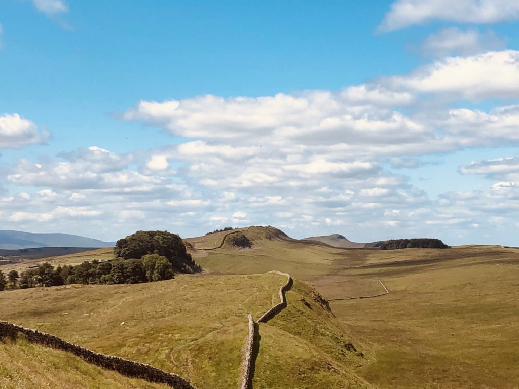
Wade knew that to build a road you need a good route, and abundant building materials. Conveniently, Hadrian’s wall provided both. The Romans were master surveyors, experts at picking straight routes for their roads, and the Wall traced a logical straight-ish route, locally using natural features like rocky or craggy terrane, such as in the photo above. There was the added benefit that the stone used to build it provided a massive supply of hard core for the road bed. Wade took full advantage of the Wall for his road, destroying much of it and siting it directly on top of it after it was levelled. The stone was crushed and used as fill, along with the forts and turrets along much of its route. Elsewhere, the locals pillaged the conveniently pre-shaped stones to help build their houses or churches.
It’s Still A Great Walk
Regardless of the absence of much of the wall, it’s a lovely walk which uses England’s ancient and rightly-revered network of public footpaths; ancient rights of way that cannot be blocked or destroyed that everyone is free to walk along. But there are enough stretches still in place that you get an inkling of what the Wall looked like when it was still in use. By the time you get to Newcastle (or Bowness), you’ll never want to see another museum of Roman history again.
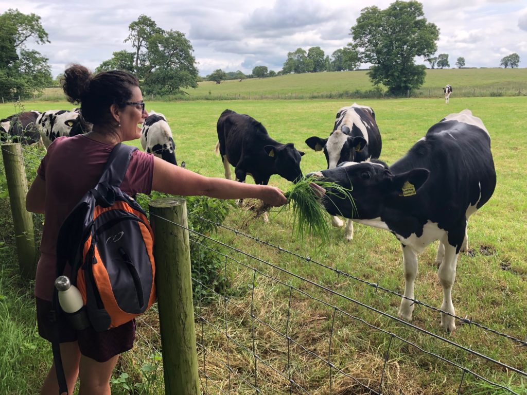
If you do ever decide to do the trek, be warned – in mid-summer, northern England doesn’t smell very nice. In fact, the countryside stinks, unlike the history. There are SO many farm animals in Cumbria and Northumberland all doing what farm animals do best, eating lots of grass and pooping, that vast swathes of both counties smell a bit ripe in hot weather. The happy farmers compound things by spraying liquid cow shit on their fields as natural fertilizer.
PS: If you fancy trying it yourself, and you want more information on where / how / what / when and all the other Ws of the walk, drop me a note through the Comments section.
Interesting post! I’d love to walk that beautiful stinky trail. Reminded me of this podcast I listened to recently – hopefully this link works ..
https://podcasts.apple.com/ca/podcast/99-invisible/id394775318?i=1000414699080
it’s definitely ripe up there mid summer!